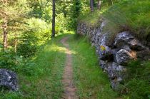
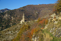
Mairatal-Rundwanderweg
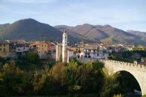
Dronero, Valle Maira Piemonte
Der Mairatalweg Percorsi occitani ist ein Rundwanderweg, welcher sich aus verschiedenen alten Wegen zusammensetzt.
Auf der rechten Talseite führt er durch grösstenteils bewaldetes Gebiet, auf der linken Talseite durch meist offenes Gelände. Im oberen Mairatal durchquert er alpine, felsige Zonen über der Waldgrenze.
Man bewegt sich Höhenlagen zwischen 600 m und 2500 m über Meer. Dem Wanderer bieten sich laufend wechselnde Landschaftsbilder und Einblicke in eine verschwundene Kultur. Das Gebiet ist stark entvölkert.
Ausgetretene Pfade
Viele Weiler sind dem Verfall preisgegeben. Man geht auf ausgetretenen Pfaden in des Wortes nicht sprichwörtlicher Bedeutung: die ehemals von Mensch und Tier gut frequentierten Wege werden heutzutage nämlich nicht mehr betreten, es sei denn von ein paar Wanderern aus dem Norden auf der Suche nach Abwechslung und Erholung.
Es kommt vor, dass man tagelang niemandem begegnet. Sollte man dennoch jemanden antreffen, kann man sich der deutschen Sprache bedienen, denn Italiener nutzen den P.O. bisher kaum. Der Weg kann ab anfangs Mai bis zu den Schneefällen, in der Regel im November, begangen werden und ist gefahrlos, da frei von ausgesetzten Stellen und durchgehend gelb markiert. Er kann deshalb auch Familien mit Kindern empfohlen werden. Erforderlich sind etwas Ausdauer und feste Wanderschuhe.
Im Frühjahr kann in höher gelegenen Zonen noch Schnee liegen, was dort eine Begehung erschweren oder verunmöglichen kann. Entsprechend ausgerüstet könnte man jedoch die Tour auch im Winter unternehmen.
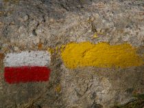
Wegmarkierungen Gta und P.O.
60 Stunden genussvoll wandern
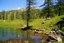
Lago Resile, Marmora, Valle Maira
Der Mairatalweg P.O. kann in insgesamt rund 60 Stunden zurückgelegt werden, die man bequemerweise auf 10 - 14 Tage verteilt. Bei einigen Strecken ist der P.O. identisch mit dem GTA-Weitwanderweg(rot-weiss markiert) sowie anderen Wegen.
An einigen Stellen weist er Varianten(blau-gelb markiert) auf. Man kann an jedem beliebigen Punkt des Rundwanderweges beginnen oder die Tour abbrechen und selbstverständlich kann man auch nur einzelne Strecken zurücklegen oder mit anderen Routen aus dem dichten Wegenetz des Mairatals kombinieren.
An einigen Stellen weist er Varianten(blau-gelb markiert) auf. Man kann an jedem beliebigen Punkt des Rundwanderweges beginnen oder die Tour abbrechen und selbstverständlich kann man auch nur einzelne Strecken zurücklegen oder mit anderen Routen aus dem dichten Wegenetz des Mairatals kombinieren.
Gut essen und übernachten
Die Pensione Ceaglio ist Mitglied der Vereinigung "Percorsi Occitani".
Das Ceaglio verfügt über ein Restaurant, Zimmer Posto Tappa (einfache Mehrbettzimmer) und komfortable Zimmer mit WC/Dusche.
Ein Hol- und Bringservice, sowie ein Gepäcktransport von Unterkunft zu Unterkunft ist im Mairatal verfügbar.
Das Ceaglio verfügt über ein Restaurant, Zimmer Posto Tappa (einfache Mehrbettzimmer) und komfortable Zimmer mit WC/Dusche.
Ein Hol- und Bringservice, sowie ein Gepäcktransport von Unterkunft zu Unterkunft ist im Mairatal verfügbar.
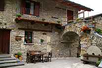
Pensione Ceaglio, Marmora-Vernetti, Valle Maira
Uhrzeiger- oder Gegenuhrzeigersinn?
Die Percorsi occitani können im Uhrzeiger- oder Gegenuhrzeigersinn begangen werden. Beide Richtungen haben ihren Reiz. Wir empfehlen, beides auszuprobieren: linksherum und im nächsten Jahr rechtsherum. Das Mairatal ist viel zu schön, um nur einmal besucht zu werden!
Originalfassung
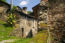
Etappe 2: Bedale e Paglieres
Die vorliegende Präsentation des Wegs folgt der ursprünglichen Fassung im Uhrzeigersinn, wobei die Gehzeiten in der Gegenrichtung ebenfalls angegeben werden. Die aufgeführten Etappen 1 und 2 werden heute selten begangen, weil es auf der relativ langen Strecke zur Zeit keine Übernachtungsmöglichkeit gibt.
Seit kurzem ist nun das Rifugio Detto Dalmastro in Santa Margherita offen.
Der Besuch dieser Gegend ist jedoch lohnend. Bisher blieb es leider bloss bei Eröffnungsankündigungen. Im Moment, muss man sich unterwegs abholen lassen oder die beiden Etappen zusammen an einem Tag zurücklegen. Der Weg ist gut markiert.
Der Besuch dieser Gegend ist jedoch lohnend. Bisher blieb es leider bloss bei Eröffnungsankündigungen. Im Moment, muss man sich unterwegs abholen lassen oder die beiden Etappen zusammen an einem Tag zurücklegen. Der Weg ist gut markiert.
Percorsi Occitani: die Etappen
Original Etappe 1
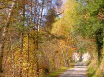 Ruà del Prato, Valle Maira
Start: Tetti di Dronero, 667 m
Ziel: Santa Margherita, 1324 m
Gehzeit: 3 h 30
Höhenunterschied: + 660 m
Gehzeit Gegenrichtung: 2 h 45
Höhenunterschied: - 660 m
Original Etappe 2
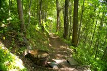 Bedale - Paglieres, Valle Maira
Start: Santa Margherita, 1324m
Ziel: Chiesa, Celle di Macra, 1270 m
Gehzeit: 3 h 30
Höhenunterschied: + 200 m, - 250 m
Gehzeit Gegenrichtung: 3.30
Höhenunterschied: + 250 m, - 200 m
Etappe 3
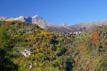 Albaretto - Macra, Valle Maira
Start: Chiesa, Celle Macra, 1270 m
Ziel: Palent, 1463 m
Gehzeit: 3 h 30
Höhenunterschied: + 575 m, - 380m
Gehzeit Gegenrichtung: 2 h 45
Höhenunterschied: + 380, - 575 m
Etappe 4
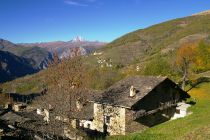 Borg. Marmora, and Monviso, Valle Maira
Start: Palent, 1463 m
Ziel: Marmora-Arata, 1389 m
Ziel: Marmora-Finello, 1370 m
Ziel: Marmora-Vernetti, 1223 m
Gehzeit: 3 h 45
Höhenunterschied: + 300 m, - 500 m(Vernetti)
Gehzeit Gegenrichtung: 4 h 30
Höhenunterschied: + 500 m, - 300 m
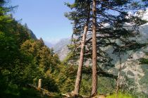 Marmora - Bassura, Stroppo, Valle Maira
Varianten: Marmora - Bassura (Stroppo)
Etappe 5
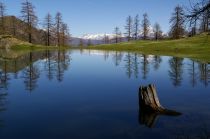 Lago Resile, Valle Maira
Start: Marmora-Vernetti, 1223 m
Ziel: La Gardetta, La Meja, 2070 m
Gehzeit: 7 h 30
Höhenunterschied: + 1350 m, - 460 m
Gehzeit Gegenrichtung: 6 h 30
Höhenunterschied: + 460 m, - 1350 m
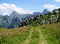 Canosio - Soleglio Bue, Valle Maira
Varianten: Marmora - Soleglio Bue - Chialvetta
Varianten: San Giovanni - Prazzo - Ussolo
Etappe 6
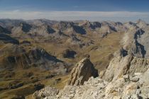 La Gardetta, von Rocca la Meja aus,Valle Maira
Start: La Gardetta-La Meja, 2070 m
Ziel: Chialvetta, 1494 m
Gehzeit: 3 h 30
Höhenunterschied: + 470 m, - 940 m
Gehzeit Gegenrichtung: 4 h 30
Höhenunterschied: + 940 m, - 470 m
Etappe 7
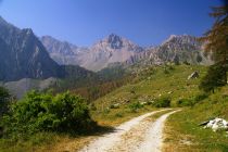 Viviere, Valle Maira
Start: Chialvetta, 1494 m
Ziel: Chiappera, 1614 m,
Gehzeit: 5 h
Höhenunterschied: + 800 m, - 670 m
Gehzeit Gegenrichtung: 4 h 30
Höhenunterschied: + 670 m, - 800 m
Etappe 8
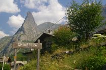 Rocca Provenzale - Chiappera, Valle Maira
Start: Chiappera, 1614 m
Ziel: Ussolo, 1340 m
Gehzeit: 4 h 30
Höhenunterschied: + 590 m, - 860 m
Gehzeit Gegenrichtung: 6 h 00
Höhenunterschied: + 860 m, - 590 m
Etappe 9
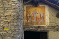 Clari - Elva, Valle Maira
Start: Ussolo 1340 m
Ziel: Elva-Serre, 1637 m
Gehzeit: 7 h 00
Höhenunterschied: + 1250 m, - 950 m
Gehzeit Gegenrichtung: 6 h 00
Höhenunterschied: + 950 m, - 1250 m
Etappe 10
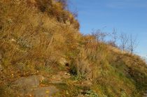 San Martino Superiore, Valle Maira
Ziel: Elva-Serre, 1637 m
Ziel: Stroppo, San Martino Inferiore, 1380 m
Gehzeit: 2 h 15
Höhenunterschied: + 250 m, - 500 m
Gehzeit Gegenrichtung: 3 h 00
Höhenunterschied: + 500 m, - 250 m
Etappe 11
Ziel: Stroppo, San Martino Inferiore, 1380 m
Ziel: Macra, 875 m
Gehzeit: 3 h 30
Höhenunterschied: + 320 m, - 930 m
Gehzeit Gegenrichtung: 5 h 00
Höhenunterschied: + 930 m, - 320 m
Etappe 12
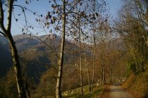 Pagliero, Valle Maira
Start: Macra, 875 m
Ziel: Pagliero, 1015 m
Gehzeit: 5 h 00
Höhenunterschied: + 650 m, - 470 m
Gehzeit Gegenrichtung: 4 h 00
Höhenunterschied: + 470 m, - 650 m
Etappe 13
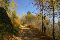 S. Anna di Roccabruna, Valle Maira
Start: Pagliero, 1015 m
Ziel: S. Anna di Roccabruna, 1252 m
Gehzeit: 3 h 00
Höhenunterschied: + 475 m, - 240 m
Gehzeit Gegenrichtung: 2 h 30
Höhenunterschied: + 240 m, - 475 m
Etappe 14
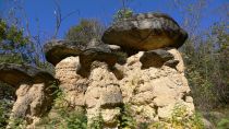 I Ciciu del Villar, Valle Maira
Start: S. Anna di Roccabruna, 1252 m
Ziel: Villar S. Costanzo, 605 m
Gehzeit: 4 h 30
Höhenunterschied: + 350 m, - 1000 m
Gehzeit Gegenrichtung: 6 h 30
Höhenunterschied: + 1000 m, - 350 m
Original Etappe 1

Ruà del Prato, Valle Maira
Ziel: Santa Margherita, 1324 m
Gehzeit: 3 h 30
Höhenunterschied: + 660 m
Gehzeit Gegenrichtung: 2 h 45
Höhenunterschied: - 660 m
Original Etappe 2

Bedale - Paglieres, Valle Maira
Ziel: Chiesa, Celle di Macra, 1270 m
Gehzeit: 3 h 30
Höhenunterschied: + 200 m, - 250 m
Gehzeit Gegenrichtung: 3.30
Höhenunterschied: + 250 m, - 200 m
Etappe 3

Albaretto - Macra, Valle Maira
Ziel: Palent, 1463 m
Gehzeit: 3 h 30
Höhenunterschied: + 575 m, - 380m
Gehzeit Gegenrichtung: 2 h 45
Höhenunterschied: + 380, - 575 m
Etappe 4

Borg. Marmora, and Monviso, Valle Maira
Ziel: Marmora-Arata, 1389 m
Ziel: Marmora-Finello, 1370 m
Ziel: Marmora-Vernetti, 1223 m
Gehzeit: 3 h 45
Höhenunterschied: + 300 m, - 500 m(Vernetti)
Gehzeit Gegenrichtung: 4 h 30
Höhenunterschied: + 500 m, - 300 m

Marmora - Bassura, Stroppo, Valle Maira
Etappe 5

Lago Resile, Valle Maira
Ziel: La Gardetta, La Meja, 2070 m
Gehzeit: 7 h 30
Höhenunterschied: + 1350 m, - 460 m
Gehzeit Gegenrichtung: 6 h 30
Höhenunterschied: + 460 m, - 1350 m

Canosio - Soleglio Bue, Valle Maira
Varianten: San Giovanni - Prazzo - Ussolo
Etappe 6

La Gardetta, von Rocca la Meja aus,Valle Maira
Ziel: Chialvetta, 1494 m
Gehzeit: 3 h 30
Höhenunterschied: + 470 m, - 940 m
Gehzeit Gegenrichtung: 4 h 30
Höhenunterschied: + 940 m, - 470 m
Etappe 7

Viviere, Valle Maira
Ziel: Chiappera, 1614 m,
Gehzeit: 5 h
Höhenunterschied: + 800 m, - 670 m
Gehzeit Gegenrichtung: 4 h 30
Höhenunterschied: + 670 m, - 800 m
Etappe 8

Rocca Provenzale - Chiappera, Valle Maira
Ziel: Ussolo, 1340 m
Gehzeit: 4 h 30
Höhenunterschied: + 590 m, - 860 m
Gehzeit Gegenrichtung: 6 h 00
Höhenunterschied: + 860 m, - 590 m
Etappe 9

Clari - Elva, Valle Maira
Ziel: Elva-Serre, 1637 m
Gehzeit: 7 h 00
Höhenunterschied: + 1250 m, - 950 m
Gehzeit Gegenrichtung: 6 h 00
Höhenunterschied: + 950 m, - 1250 m
Etappe 10

San Martino Superiore, Valle Maira
Ziel: Stroppo, San Martino Inferiore, 1380 m
Gehzeit: 2 h 15
Höhenunterschied: + 250 m, - 500 m
Gehzeit Gegenrichtung: 3 h 00
Höhenunterschied: + 500 m, - 250 m
Etappe 11
Ziel: Macra, 875 m
Gehzeit: 3 h 30
Höhenunterschied: + 320 m, - 930 m
Gehzeit Gegenrichtung: 5 h 00
Höhenunterschied: + 930 m, - 320 m
Etappe 12

Pagliero, Valle Maira
Ziel: Pagliero, 1015 m
Gehzeit: 5 h 00
Höhenunterschied: + 650 m, - 470 m
Gehzeit Gegenrichtung: 4 h 00
Höhenunterschied: + 470 m, - 650 m
Etappe 13

S. Anna di Roccabruna, Valle Maira
Ziel: S. Anna di Roccabruna, 1252 m
Gehzeit: 3 h 00
Höhenunterschied: + 475 m, - 240 m
Gehzeit Gegenrichtung: 2 h 30
Höhenunterschied: + 240 m, - 475 m
Etappe 14

I Ciciu del Villar, Valle Maira
Ziel: Villar S. Costanzo, 605 m
Gehzeit: 4 h 30
Höhenunterschied: + 350 m, - 1000 m
Gehzeit Gegenrichtung: 6 h 30
Höhenunterschied: + 1000 m, - 350 m

